Other Vital Information
Directional Road Signs
To complement the maps and trail notes contained within the Guidebook, the entire Trail route has been sign-posted with directional road signs. These signs are strategically placed at intersections and turning points. In addition, there are signs indicating the location of each official site (stopping point), at which there are also one or more information panels. So, you can follow the signs for the overall direction of the trail and use the Guidebook for the finer detail on what to look out for along the way. It’s navigation made easy!
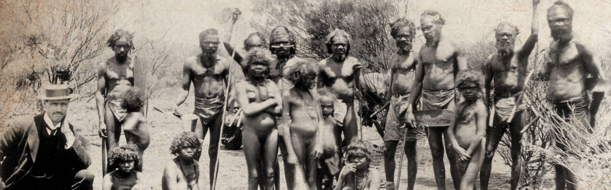
Aboriginal Communities
While the Golden Quest Discovery Trail does not pass directly through any Aboriginal communities, it does pass by several. These communities are not open to the public and should not be entered without prior permission or permits. We urge you to respect the privacy of the residents. For further information, you may wish to contact the Department of Aboriginal Affairs – www.daa.wa.gov.au
Old mine workings
Some disused mineshafts, diggings and other old mine workings in the Goldfields have been fenced off or have warning signs prominently displayed. There are many, however, that have neither fences nor signs, including that are close to designated Golden Quest sites. These areas are unsafe and you should keep well away at all times, only walking on clearly defined tracks and pathways. You are urged to make ‘staying on the Trail’ a priority to ensure your personal health and safety.
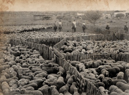
Sheep station
Pastoral Stations
The Trail passes through many active pastoral leases with large numbers of livestock. Do not travel off-road within pastoral properties without the prior permission of the relevant station owner or manager.
Mobile Phone Coverage
Presently the cellular network only covers the populated centres of Coolgardie, Kalgoorlie-Boulder, Menzies, Leonora and Laverton. Outside of these centre, mobile phone coverage is intermittent. For travelers wishing to stay in the region for a number of days, it is suggested to carry a satellite phone or tracking device which can be used in case of emergency.
Fire Bans
From time to time, total fire bans are imposed throughout the region, particularly during periods of prolonged hot weather. Total fire bans are announced on local radio. However, if you are unsure whether a fire ban is in place, contact the nearest local government office. Regardless of whether a total fire ban is in place, never light a campfire anywhere other than a designated camping or barbeque area.
Pets, particularly dogs
If you’re travelling with a pet, particularly a dog, never let them roam free. Throughout the region, an abundance of poison baits are scattered to control wild dogs and foxes that pose a threat to livestock on pastoral properties.
Letting family and friends know where you are
It is strongly recommended that you inform family and/or friends of your travel plans and expected dates of arrival and return. If possible, provide them with a copy of your proposed itinerary and continue to update them of any changes.
Visitor Services
The major towns along the Trail route – Coolgardie, Menzies, Laverton, Leonora and Kalgoorlie-Boulder – all provide a range of accommodation, food outlets and service stations. Two smaller centres (Broad Arrow and Kookynie) provide food and accommodation, with fuel also available at Kookynie.
Caravan parks and/or camping facilities are located at Coolgardie, Ora Banda, Menzies, Niagara Dam, Kookynie, Laverton, Rowles Lagoon and Kalgoorlie-Boulder.
Please note that the long western section of the Trail between Leonora and Ora Banda via Copperfield and Davyhurst has no food or fuel outlets, and the only camping and toilet facilities are at Rowles Lagoon. Before undertaking this section of the Trail, it is vital that you ensure you have a full tank of fuel, plenty of water and a supply of food.